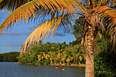
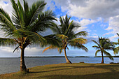
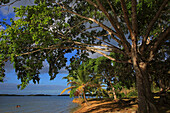
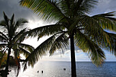
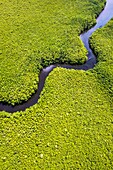
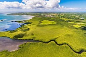
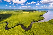
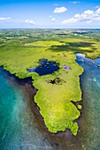
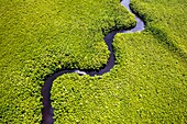
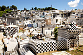
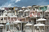
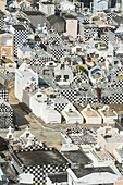
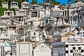
14226666 - France,French Antilles,Guadeloupe. Morne a l'eau. Babin bay14226667 - France,French Antilles,Guadeloupe. Morne a l'eau. Babin bay14226659 - France,French Antilles,Guadeloupe. Morne a l'eau. Babin bay14226662 - France,French Antilles,Guadeloupe. Morne a l'eau. Babin bay14226660 - France,French Antilles,Guadeloupe. Morne a l'eau. Babin bay14226668 - France,French Antilles,Guadeloupe. Morne a l'eau. Babin bay13929872 - France, Caribbean, Lesser Antilles, Guadeloupe, Grand Cul-de-Sac Marin, heart of the Guadeloupe National Park, Grande-Terre, Morne-à-l'Eau, Canal Cove, aerial view on the widest mangrove belt of the Lesser Antilles, Biosphere Reserve of Guadeloupe, here the Canal des Rotours, dug over nearly 6 km at the beginning of the 19th century (1826-1830) by hand of Men, slaves, to allow the drainage of the plain\n13933770 - France, Caribbean, Lesser Antilles, Guadeloupe, Grand Cul-de-Sac Marin, heart of the Guadeloupe National Park, Grande-Terre, Morne-à-l'Eau, Canal Cove, aerial view on the widest mangrove belt of the Lesser Antilles, Biosphere Reserve of Guadeloupe, here the Canal des Rotours, dug over nearly 6 km at the beginning of the 19th century (1826-1830) by hand of Men, slaves, to allow the drainage of the plain\n13931919 - France, Caribbean, Lesser Antilles, Guadeloupe, Grand Cul-de-Sac marin, heart of Guadeloupe national park, Grande-Terre, Morne-à-l'Eau, Canal cove, aerial view on the wider mangrove belt of the Lesser Antilles, Guadeloupe Biosphere Reserve, here the Canal des Rotours, dug for nearly 6 km at the beginning of the 19th century (1826-1830) by hand of men, slaves, to allow drainage of the plain\n13935986 - France, Caribbean, Lesser Antilles, Guadeloupe, Grand Cul-de-Sac Marin, heart of the Guadeloupe National Park, Grande-Terre, Morne-à-l'Eau, Canal Cove, aerial view on the widest mangrove belt of the Lesser Antilles, Guadeloupe Biosphere Reserve\n13934368 - France, Caribbean, Lesser Antilles, Guadeloupe, Grand Cul-de-Sac Marin, heart of the Guadeloupe National Park, Grande-Terre, Morne-à-l'Eau, Canal Cove, aerial view on the widest mangrove belt of the Lesser Antilles, Biosphere Reserve of Guadeloupe, here the Canal des Rotours, dug over nearly 6 km at the beginning of the 19th century (1826-1830) by hand of Men, slaves, to allow the drainage of the plain\n70020779 - Cemetery Morne a l'Eau, Grande-Terre, Guadeloupe71322587 - France, Guadeloupe (French West Indies), Grande Terre, Morne a l'Eau, the cemetery with its black and white chequered tombs71322586 - France, Guadeloupe (French West Indies), Grande Terre, Morne a l'Eau, the cemetery with its black and white chequered tombs71314646 - France, Guadeloupe (French West Indies), Grande Terre, Morne a l'Eau, cemetery with approximately 1800 graves decorated with black and white tiled